More than two years after road access and electrical power to the Mauna Loa Observatory was cut off by lava flows, NOAA staff continue to make critical measurements of the atmosphere and other environmental variables at the remote site.
In 2023, observatory staff installed solar panels at the site and resumed some measurements, including the independent carbon dioxide monitoring programs run by the Global Monitoring Laboratory and Scripps Institution of Oceanography, as well as other atmospheric measurements.
Construction of a temporary road to access the observatory site is anticipated to begin in summer 2025.
Media can contact: Theo Stein (303) 819-7409 (theo.stein@noaa.gov)
Introduction
Trinidad Head is located along the rugged northern coast of California. The coastal climate is dominated by maritime influences, with moderate year-round temperatures and moderate-to-high humidity. To the immediate west is the unobstructed Pacific Ocean and to the east are redwood-dominated forest lands. Because of the characteristics of a relatively remote coastal location (insignificant anthropogenic influences and prevailing maritime airflow), the Trinidad Head site is an important new addition to the NOAA ESRL Baseline Monitoring Network and a good site for Lidar.

Results
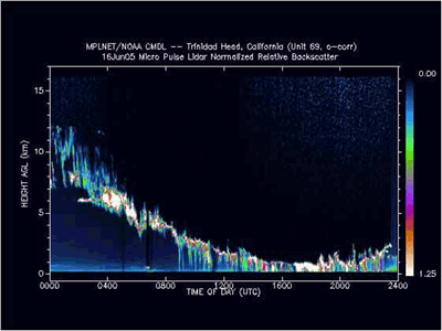
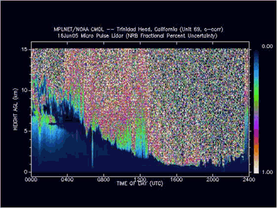
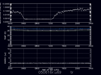
The following results are from June 16, 2005. They can be found with much more data at the Micropulse Lidar Network web site (http://mplnet.gsfc.nasa.gov/)
Micro-Pulse Lidar (MPL)
Micro Pulse Lidar (MPL) is a conventional time-gated, incoherent detection lidar approach able to profile all significant atmospheric cloud and aerosol structure with a compact, fully eye-safe instrument. Eye-safety, allowing for full-time, long-term unattended operation, is accomplished by transmitting low power pulses using an expanded beam (10 micro-Joules with a 0.2 m exit-aperture width and 1.2E-6 beam divergence), with a pulse repetition frequency much higher than standard lidar systems (2.5 kHz). Signal acquisition is handled via photon counting for a relatively more accurate and problem free means of handling low level signal than analog detection (see http://mplnet.gsfc.nasa.gov)
LIDAR at Trinidad Head
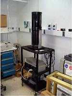
In 2005, the station trailer at Trinidad Head was fitted with a skylight port to accomodate a NASA Micro-pulse lidar system, which is is now operational as part of the CIFEX campain. CIFEX (Cloud Indirect Effects Experiments) is a campaign sponsored by the Scripps Institution for Oceanography (SIO) that will focus on the Asian brown cloud and the relationship between aerosol microphysics and cloud microphysics and will investigate the impact of particles on cloud properties and precipitation efficiency.
Lead Investigator(s):
Dr. John E.
Barnes
808-933-6965 (x222)
Dave Hoffman
303-497-6966
Date Started:
05/06/2005
Related Programs:
Mauna Loa (HI) Lidar
Boulder (CO) Lidar
Samoa Lidar
Camera Lidar
General Lidar Info
Lidar Specifications
Station Alt: 107 m
Latitude: 41.03 N
Longitude: 124.09 W
Time Zone: GMT -8
Laser Type: Nd:YAG
Frequency: Daily
Acq Board: AMCS
# Channels: 1
(nm) used: 532nm

